 https://canadiangis.com/wp-content/uploads/York-University-Vari-Hall.jpg
2592
3888
tmackinnon
https://canadiangis.com/wp-content/uploads/CanadianGIS-rec-logo-2021-v4.png
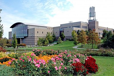
tmackinnon2017-06-02 14:53:062017-08-22 17:37:43York University – GIS and Remote Sensing
https://canadiangis.com/wp-content/uploads/York-University-Vari-Hall.jpg
2592
3888
tmackinnon
https://canadiangis.com/wp-content/uploads/CanadianGIS-rec-logo-2021-v4.png
tmackinnon2017-06-02 14:53:062017-08-22 17:37:43York University – GIS and Remote SensingCanadian GIS Education Programs
The ever evolving Canadian Geomatics Industry has lead to increased demands for specialized GIS training, and Canada remains to be leaders in geographic education providers.
Because the study of GIS often combines several technological tools, methods and procedures, students are usually required to grasp many concepts at once, therefore most programs occur at either the University or advanced College level (although GIS is occurring more and more K-12 classrooms thanks to programs like the GIS Ambassador program).
The Canadian GIS Education Programs section covers all GIS programs offered in Canada; find information about University Programs, College Programs and Online GIS Programs with program details, videos, links, student reviews and much more
CanadianGIS.com helps show where all of the GIS Education Programs in Canada are spatially located, the type of program they are, what skills they have to offer, which ones are best suited for you and how you can find out more.
If you know of anything related to Canadian geographic information that you would like to share with the thousands of viewers that frequent our site then we would love to hear from you.
Browse some of the recent content Added to the Canadian GIS and Geomatics site:
 https://canadiangis.com/wp-content/uploads/York-University-Vari-Hall.jpg
2592
3888
tmackinnon
https://canadiangis.com/wp-content/uploads/CanadianGIS-rec-logo-2021-v4.png
tmackinnon2017-06-02 14:53:062017-08-22 17:37:43York University – GIS and Remote Sensing
 https://canadiangis.com/wp-content/uploads/University-of-Winnipeg.jpg
768
1024
tmackinnon
https://canadiangis.com/wp-content/uploads/CanadianGIS-rec-logo-2021-v4.png
tmackinnon2017-02-22 18:54:022017-11-30 20:44:31University of Winnipeg – Red River College GIS Program
 https://canadiangis.com/wp-content/uploads/Niagara-College-Glendale-Campus1.jpg
266
400
tmackinnon
https://canadiangis.com/wp-content/uploads/CanadianGIS-rec-logo-2021-v4.png
tmackinnon2016-12-01 08:56:242017-08-19 17:44:15Niagara College
 https://canadiangis.com/wp-content/uploads/Southern-Alberta-Institute-of-Technology.jpg
1920
2576
tmackinnon
https://canadiangis.com/wp-content/uploads/CanadianGIS-rec-logo-2021-v4.png
tmackinnon2016-06-22 23:25:462017-10-25 19:24:01Southern Alberta Institute of Technology (SAIT)
 https://canadiangis.com/wp-content/uploads/University-of-Waterloo-Geomatics.png
480
640
tmackinnon
https://canadiangis.com/wp-content/uploads/CanadianGIS-rec-logo-2021-v4.png
tmackinnon2016-05-01 08:28:362017-08-19 12:56:41Trent University
 https://canadiangis.com/wp-content/uploads/2016/04/Acadia-University.jpg
266
400
tmackinnon
https://canadiangis.com/wp-content/uploads/CanadianGIS-rec-logo-2021-v4.png
tmackinnon2016-02-01 07:36:142017-08-19 12:53:17Acadia University
 https://canadiangis.com/wp-content/uploads/MUN.jpg
768
1024
tmackinnon
https://canadiangis.com/wp-content/uploads/CanadianGIS-rec-logo-2021-v4.png
tmackinnon2016-01-28 21:29:132017-08-19 13:04:45Memorial University of Newfoundland (MUN)
 https://canadiangis.com/wp-content/uploads/Dalhousie-University-1-1.jpg
899
1600
tmackinnon
https://canadiangis.com/wp-content/uploads/CanadianGIS-rec-logo-2021-v4.png
tmackinnon2015-08-26 20:48:342017-08-19 13:12:16Dalhousie University
 https://canadiangis.com/wp-content/uploads/University-of-Waterloo.jpg
1050
1681
tmackinnon
https://canadiangis.com/wp-content/uploads/CanadianGIS-rec-logo-2021-v4.png
tmackinnon2015-07-26 21:39:332017-08-19 13:19:24University of Waterloo
https://canadiangis.com/wp-content/uploads/University-of-Waterloo.jpg
1050
1681
tmackinnon
https://canadiangis.com/wp-content/uploads/CanadianGIS-rec-logo-2021-v4.png
tmackinnon2015-07-26 21:39:332017-08-19 13:19:24University of WaterlooMore results ...
Content Added to Site Recently
![World Shaded Relief KMZ file [free download] World Shaded Relief Map](https://canadiangis.com/wp-content/uploads/World-Shaded-Relief-Map-1-36x36.jpg) World Shaded Relief KMZ file [free download]November 9, 2023 - 9:22 pm
World Shaded Relief KMZ file [free download]November 9, 2023 - 9:22 pm Guidelines for Real Time Kinematic (RTK) SurveyingOctober 5, 2023 - 6:20 pm
 GIS jobs in OttawaMay 18, 2023 - 1:01 pm
 Canadian Boundary files (Open Data)May 17, 2023 - 10:35 am
 Montreal 3D Buildings (Open Data)May 16, 2023 - 10:18 am
Canadian GIS Education Programs
 York University – GIS and Remote SensingJune 2, 2017 - 2:53 pm
 University of Winnipeg – Red River College GIS ProgramFebruary 22, 2017 - 6:54 pm
 Niagara CollegeDecember 1, 2016 - 8:56 am


