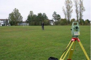
Ryerson University Geomatics
Ryerson University located in Toronto, Ontario is probably best known as a public research University. The university is composed of 31,000+ undergraduate students, 2,200+ graduate students, and 65,000+ continuing education students.
Ryerson University Geomatics
 The institute has built a solid reputation over the years and is well known for the programs that it offers with the majority of them emphasizing applicable hands on skills and training. As a result, Ryerson University has established it self with a reputation for producing career ready graduates ready for the work place.
Ryerson University offers a number of various options to people who want to pursue a Geomatics career with several programs witch we cover here briefly. If you are in the Toronto area and want to study Geomatics then you should contact the web sites and contact people mentioned to find out more information to help aid your decision.
Programs: Bachelor of Arts in Geographic Analysis, Post-Graduate GIS Certificates, Master of Spatial Analysis (MSA), Bachelor of Engineering (B.Eng.) degree in Civil Engineering (with a Geomatics Engineering option)
Contact Info: Each program has a different contact person, so click on the program below that you wish to obtain the contact information for:
- Bachelor of Arts in Geographic Analysis
- Post-Graduate GIS Certificates
- Master of Spatial Analysis (MSA)
- Bachelor of Engineering (B.Eng.) degree in Civil Engineering (with a Geomatics Engineering option)
Address
350 Victoria Street
Toronto, Ontario
M5B 0A1Contact Info
(416) 979-5000
Links
Videos
Note: The content provided in this section of our website is crowd sourced / community driven and comes from multiple sources which are provided when possible.
If you would like to contribute more information, or advise us of any incorrect details about the program highlighted here on this page then please feel free to contact us. feedback is always welcome.
More Canadian GIS / Geomatics Programs
 https://canadiangis.com/wp-content/uploads/York-University-Vari-Hall.jpg
2592
3888
tmackinnon
https://canadiangis.com/wp-content/uploads/CanadianGIS-rec-logo-2021-v4.png
tmackinnon2017-06-02 14:53:062017-08-22 17:37:43York University – GIS and Remote Sensing
 https://canadiangis.com/wp-content/uploads/University-of-Winnipeg.jpg
768
1024
tmackinnon
https://canadiangis.com/wp-content/uploads/CanadianGIS-rec-logo-2021-v4.png
tmackinnon2017-02-22 18:54:022017-11-30 20:44:31University of Winnipeg – Red River College GIS Program
 https://canadiangis.com/wp-content/uploads/Niagara-College-Glendale-Campus1.jpg
266
400
tmackinnon
https://canadiangis.com/wp-content/uploads/CanadianGIS-rec-logo-2021-v4.png
tmackinnon2016-12-01 08:56:242017-08-19 17:44:15Niagara College
 https://canadiangis.com/wp-content/uploads/Southern-Alberta-Institute-of-Technology.jpg
1920
2576
tmackinnon
https://canadiangis.com/wp-content/uploads/CanadianGIS-rec-logo-2021-v4.png
tmackinnon2016-06-22 23:25:462017-10-25 19:24:01Southern Alberta Institute of Technology (SAIT)
 https://canadiangis.com/wp-content/uploads/University-of-Waterloo-Geomatics.png
480
640
tmackinnon
https://canadiangis.com/wp-content/uploads/CanadianGIS-rec-logo-2021-v4.png
tmackinnon2016-05-01 08:28:362017-08-19 12:56:41Trent University
 https://canadiangis.com/wp-content/uploads/2016/04/Acadia-University.jpg
266
400
tmackinnon
https://canadiangis.com/wp-content/uploads/CanadianGIS-rec-logo-2021-v4.png
tmackinnon2016-02-01 07:36:142017-08-19 12:53:17Acadia University


