Sources of Nova Scotia Geospatial Data
/
0 Comments
On this page we maintain a dynamic growing list of sources where you can download Nova Scotia open data and related Nova Scotia geospatial data to use in GIS applications ...

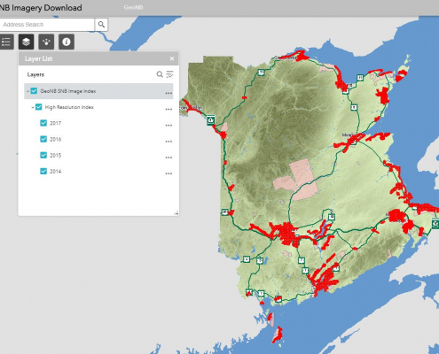
Download New Brunswick High Resolution Imagery
The Province of New Brunswick recently added a new online web application to their arsenal of online mapping and data tools. The new online web application allows the public to download high resolution digital aerial imagery acquired throughout New Brunswick available at a variety of image resolutions.

Newfoundland and Labrador OpenData
Looking for data sets featuring Newfoundland and Labrador? Then you should check out the Newfoundland and Labrador OpenData. They are providing data in various accessible formats numerical tabular styled files as well as common text formats.

RADARSAT Data and Mosaics
Canada's first Earth observation satellite, was declared non-operational earlier this year. RADARSAT 2 launched in 2007 was designed to replace RADARSAT 1 and is used for a variety of applications such as sea ice mapping, ship detection, agricultural monitoring, pollution detection, geological mapping, land use mapping, and much more.
Here are links to several RADARSAT data and mosaic images that you can download completely free.

Prince Edward Island Atlas
Comprehensive overview of geographic information featuring the province of Prince Edward Island, download the 100 page full color PEI Road Atlas free ...

OpenStreetMap Step by Step User Guides
If you have been following our OpenStreetMap topic over the past few months then I am sure you have come to the realize that it is a community driven project and that anyone can edit OpenStreetMaps. But where does one start?
Here are some free user guides to help you get started using OpenStreetMap.

East Hants Open Data
East Hants, Nova Scotia, Canada is a vibrant municipality between Metro Halifax and the Bay of Fundy. East Hants uses GIS technology in all their departments, from sewer, water, and road projects, to regional planning, taxation, and municipal elections. Recently they developed an online portal (Interactive East Hants) to help Nova Scotian's explore their growing Municipality's geospatial data sets.

OpenStreetMap – the Power of the People
OpenStreetMap launched 10 years ago with the slogan of Free Wiki World Map has taken developers and map lovers by surprise, providing editable map data, making it easier for people to interact and navigate. So to help celebrate 10 years of OpenStreetMap we have created a series of articles dedicated to open source mapping and web applications that have been either built with or that make use of OpenStreetMap.

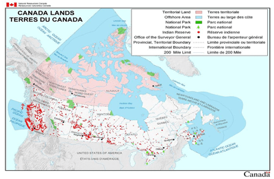
Canada Lands Digital Cadastral Data & Mapping Applications
Canada Lands are any federal Crown lands belonging to the Crown, that are situated in Yukon, the Northwest Territories, Nunavut or in any National Park or Indian Reserve, as defined by the Indian Act. Digital cadastral data of Canada Lands depicting the internal and external boundaries is managed by Natural Resources Canada, and is made available for public use in a variety of formats.
Here are links to pre-made mapping products and digital cadastral datasets related to Canada Lands as well as the Canada Lands overlay in Google Earth file and the Canada Lands Survey System online map browser.

 Open Data is used in industries such as agriculture, forestry, engineering, urban planning, oil and gas, and mining. Geomatics software includes Geographic Information Systems (GIS), satellite imagery, surveying and mapping software, and other specialized applications.