The City of Montréal promotes information sharing with the community and takes advantage of the collective wealth, by making its data accessible to everyone.
Browse the various MontréalOpen Data available ...
The City of Whitehorse GIS Open Data portal provides various data layers in CAD, GIS, and Google Earth formats. Download data sets related to base map data, transportation, environment, infrastructure, land use planning, municipal data, property, and aerial photography.
The Taber Open Data collection includes LiDAR data, digital elevation models, topographic data and much more ...
GeoYukon map viewer allows users to search, display, print and download the Yukon Government’s authoritative spatial data. Data is provided as a free public service.
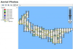
The province of Prince Edward Island has always been pretty good and open about making their PEI aerial photography freely available. You can download scanned Aerial Photography dating back to 1935 ...
The Québec government, along with many of the municipalities of like Laval, Quebec City and Sherbrooke (all had their own open data portals) joined forces in 2016 to create the Québec open data portal. Many other municipalities then followed, and now the site contains almost a thousand different data sets.
Therefore Quebec Open Data should always be the best starting point when looking for data for places in the Province of Quebec.
Strathcona County is committed to enable any member of the public to ‘unleash the value’ within the Strathcona County Open Data catalogue. Individuals, groups or classrooms, businesses or the community at large are some of the users who may find value in the data.
The City of Regina Open Data website provides the public with "self-serve" access to city data/information for download or viewing in different formats. Members of the public can access the information to do data analysis, mapping, chart creation or develop applications.

