Free Data and Software
Geospatial data and software are used to collect, analyze and interpret geographic information. Geomatics is the science of collecting, storing, analyzing and interpreting spatial data. Geospatial data can be used in a variety of applications such as mapping, surveying, navigation, land use planning, environmental monitoring, and resource management.
Geomatics data and software are used in industries such as agriculture, forestry, engineering, urban planning, oil and gas, and mining. Geomatics software includes Geographic Information Systems (GIS), satellite imagery, surveying and mapping software, and other specialized applications.
The combination of these technologies allow for efficient and accurate data collection and analysis, as well can be used to help identify trends and patterns in the environment, track the movement of animals and natural resources, and monitor the health of ecosystems. Geomatics data and software are essential for understanding and managing the Earth’s resources.
We use the “Free Data and Software” section of our site to share various information about free data & software that we use or know about. See the various pages listed further below for more information …
If you have information related to Free Data & Software that you think we should share here, then please do let us know.

This handy color shaded relief map of the world including oceans was created from the NOAA ETOPO1 data set and was intended to be used with handheld Garmin GPS units, but can also make a nice colorful back ground image to use in Google Earth. Find out how to download this free resource ...
")
The Canadian Boundary files data comes in two types: cartographic and digital. The Cartographic boundary files represent geographic areas using Canada’s main landmass and coastal islands. Digital boundary files, on the other hand, depict the complete extent of the geographic areas, including coastal water areas.
")
Discover the Montreal 3D Buildings (open data) layers. Unleash the power of geographic information with access to a wealth of data on the city of Montreal’s architectural landscape that offers a virtual exploration of the city’s urban fabric. Whether you’re an urban planner, architect, or simply a curious enthusiast, our open data platform empowers you to unlock new insights and reimagine Montreal’s skyline.

Over the past few years CanadianGIS.com has been highlighting and promoting various cities and provinces in Canada that have done a great job providing data and applications to the public.
We created this page a few years ago to collaborate links of all the open geospatial data info (sites that offer data downloads at no cost and without restrictions), fee based geospatial data, online web mapping applications and other great sources of geospatial information (including National, Provincial and Regional levels).
This comprehensive list of open geospatial data, fee based geospatial data, web mapping applications and cartographic products is a valuable asset to many people (... we get hundreds of emails and requests regarding "Where can I find data for ...?") so we continue to update it with new information and sources of Canadian data sets.

Since starting our Open Data Resources page in 2010, we have received thousands of requests from people looking for various geospatial data to use with their geospatial projects. We now have an ongoing list of places where you can find Canadian Lidar Data that is available to use for free.
We hope that as more people start using this data and that the geospatial community will help us add more Canadian LiDAR Data sources to this page ...

Beautiful Northern Canada Map featuring the Canadian North in support of Natural Resources Canada and the Government of Canada’s Northern Strategy. This bilingual map product (available either in paper or digital formats) features the vast geography of the north from approximately 50° latitude and above.

The map depicts Indigenous Place Names in Canada, shared by several First Nations, Métis, and Inuit communities. A high resolution digital version is provided that may be downloaded for free and printed for personal or educational uses.

The ‘Learning GIS with Game of Thrones’ guide is aimed to encourage people to learn GIS with a user-friendly open source GIS software while having some fun ...

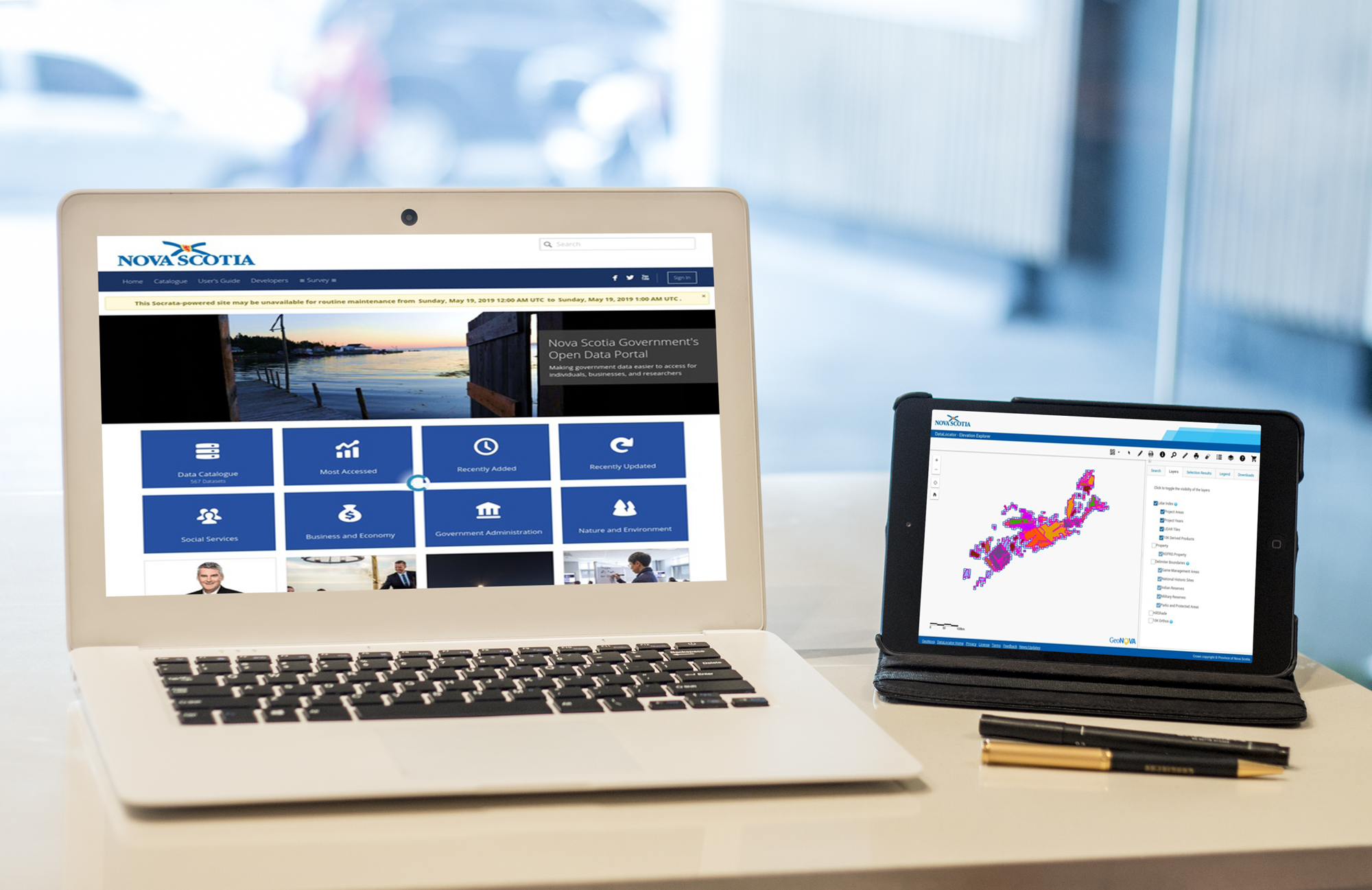
Recently Nova Scotia joined the growing number of Canadian Provinces and Municipalities that offer open data, when it officially launched the Nova Scotia open data portal providing public access to more than 135 different data sets
Open Data is about drawing on the collective knowledge and innovation of Nova Scotians to help grow our economy and improve the lives of those around us ...