ColorBrewer is a simple online tool that helps you choose appropriate color schemes to use with your online mapping projects. It works with 3 different types of data schemes: sequential (data that ranges from low to high), diverging (data with equal an emphasis on critical values and extremes) or qualitative ( best suited for nominal or categorical data).
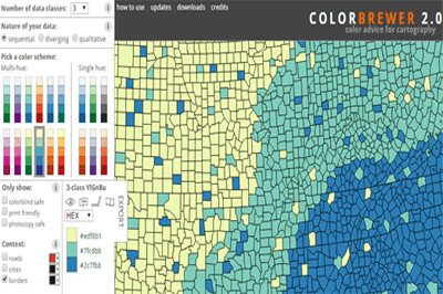 You start with a sample map that does not depict actual data but has been carefully designed for evaluating the robustness of color schemes.
Choose the types of data scheme that best suits your data set, next select the number of data classes and then select a color palette range. Then you will be provide with the color codes that best represents your data.
You can also download a ColorBrewer style file for use in ArcGIS, Excel file including all color schemes in one file, CartoCSS styles and several other formats.
Try Color Brewer
To start using ColorBrewer go to colorbrewer2.org


![World Shaded Relief KMZ file [free download] World Shaded Relief Map](https://canadiangis.com/wp-content/uploads/World-Shaded-Relief-Map-1-260x185.jpg)
