Historic Cartography
 Maps convey geographic information about places and help us to better understand topography, environment, culture and more.
Cartography is the art and science of making maps is an old profession that has been practiced since ancient Babylonia times. Back them, most maps were created for navigation purposes and to help depict territorial regions.
Canada is a relative young country (when compared to others) and thus experienced many years of European exploration that resulted in the creation of many maps that tried to show part of the world that had not been mapped before.
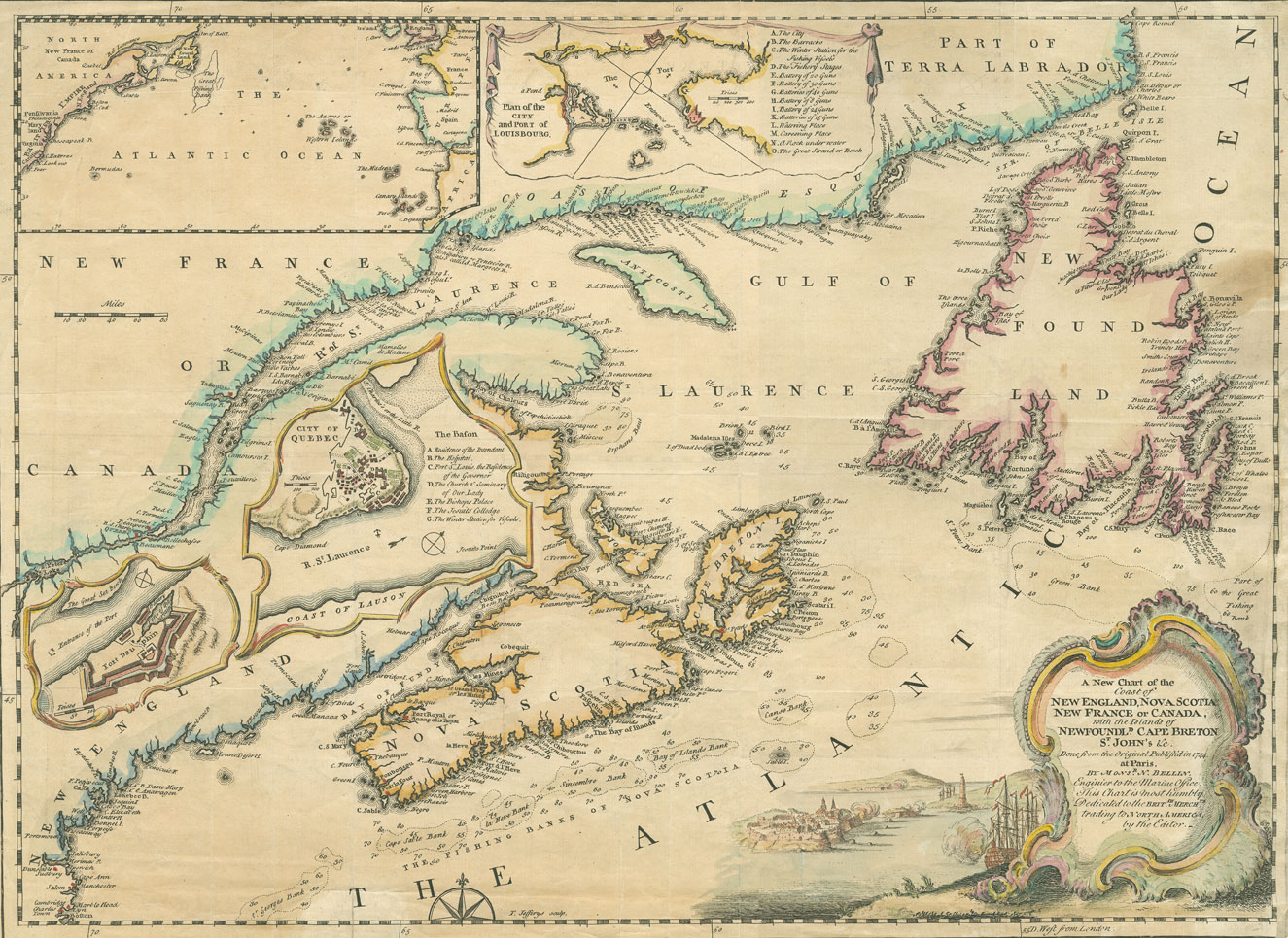
The “Historic Cartography” section of our site was created to explore the many great sources of vintage cartography in Canada. From detailed hand drawn maps by early explorers whom created and documented some of the earliest spatial representations of Canada to maps that focus on nature, the north, and our people.
The following pages listed below are related to Historic Cartography …

Canada is certainly not an old country when compared to many others like France or the UK but it has been around long enough to have some very interesting history.
Here are some historic aerial images of major cities in Canada. It is interesting to compare some of these with modern maps and aerial images to get a real appreciation on what urban sprawl is and how cities develop and spread over time.

I recently returned from giving a presentation at Carto2013; an annual Canadian cartographic themed conference that was held at the University of Alberta co-hosted by the Canadian Cartographic Association (CCA) & the Association of Canadian Map Libraries and Archives (ACMLA).
One of the key themes evident at the conference was related to history of cartography and history through maps", a topic that many of the presentations were related to and several of these talks were about 1826 maps of Northwestern North America created by David Thompson. I myself have never really had much interest in history however these presentations provided me with a much different perspective on history and maybe I have found myself a new (or old??) to explore. Yesterday while searching for some Canadian maps with my daughter I stumbled across yet some more historic themed cartography, so I thought perhaps we should start a new section on CanadianGIS.com related to Historic Cartography since it is pretty evident that this is becoming topic of interest to many in the Canadian Geomatics community.
Find out more about Canadian Geographic Maps & Thompson’s 1826 Map of Northwestern North America ...

Today we have a scan of a Vancouver Mission (British Columbia) Route Map taken from The Automobile Blue Book published in 1917.