Posts
GIS jobs in Alberta
/
0 Comments
Looking for GIS jobs in Alberta? Try checking out some of the various employment opportunities listed here (this is a dynamic page so is updated often) or use the job search tools in our geomatics employment section ...

1921 Map of Alberta
Large historic map of Alberta taken from Putnam's Handy Volume Atlas of the World that was published in 1921
Canadian Cartographic Association Student Map Competition
Every year the CCA announces awards, prizes and scholarships for Canadian post-secondary students involved in any forms of cartography or map-making. Find out how you could get some $$ for maps you create while at school!!!

RADARSAT Data and Mosaics
Canada's first Earth observation satellite, was declared non-operational earlier this year. RADARSAT 2 launched in 2007 was designed to replace RADARSAT 1 and is used for a variety of applications such as sea ice mapping, ship detection, agricultural monitoring, pollution detection, geological mapping, land use mapping, and much more.
Here are links to several RADARSAT data and mosaic images that you can download completely free.
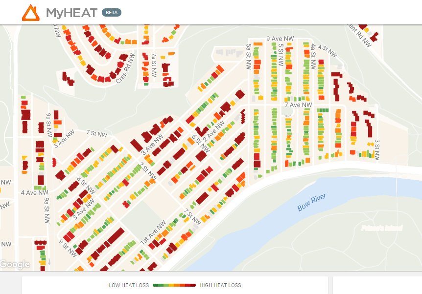
Canada’s first urban heat loss map of over 500,000 homes
MyHEAT Inc. launches a new way to reduce the cost of heating and cooling their homes, or commercial buildings, while also contributing to the fight against climate change. The MyHEAT platform gives the ability to visualize and compare the heat escaping from every building in a town or city, and is available free of charge.
As of today the platform is live in Calgary, Okotoks, Airdrie, Edmonton, and Sherwood Park, with over 500,000 houses profiled. Additional Alberta communities will be added over the coming months, with a planned roll out across major urban Canadian cities over the next year.

Breathtaking Aerial Views of Calgary
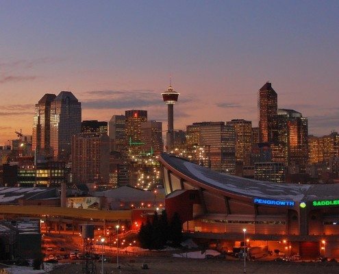
Calgary, situated along the Bow River is a cosmopolitan city with numerous skyscrapers as this breathtaking aerial footage of Calgary shows ...
GIS jobs in Calgary
Calgary is Alberta's largest city and the third largest in Canada, the economic activity happening in Calgary is very hot these days and mostly involved with the petroleum industry, but the Geomatics industry also contributes to Alberta's economic growth and here we have some of the latest GIS jobs in the Calgary area for you.

Historical Orthophotos of Alberta
Historical Orthophotos of Alberta contains georeferenced orthophoto maps consisting of aerial photography mainly from 1949 to 1951 with coverage for the whole province. It also contains various maps created with photos from 1961 to 1963. Each of the original maps covers a 1:50,000 NTS sheet at a scale of 1:63,360.
To download the georeferenced orthophoto maps ...

Town of Banff Online Maps and Apps
As many of you already know or perhaps may have recently discovered, CanadianGIS.com has been high-lighting places in Canada that have an online web mapping site or application in order to help better provide information to their residents.
Now this month the Town of Banff is featured as they too have now joined the spatial ranks of several other Cities and Municipalities in Canada with the launch of their own online mapping site (Simply check out the Web Maps category link or the site search tools along the right side to find many other great Canadian Online Map sites featured).
The Maps and Apps website created by the Town of Banff GIS and IT departments provides free public access to maps and geospatial applications that help the Town of Banff provide better services and connect with it's own citizens in a new way.
