• Facebook
  • Twitter
  • Linkedin
  • Gplus
  • Mail
  • Pinterest
  • Rss
Canadian GIS & Geomatics
  • Canadian Data
    • Free Canadian LiDAR Data
    • Canadian Open Data
    • Contribute Canadian GIS and Geomatics Information
  • Geomatics Sector News
    • Submit a Press Release
  • GIS Education
    • Contribute Info About GIS / Geomatics Education Programs
  • Historic Cartography
  • Search
  • Menu

Canada’s
first urban
heat loss
map of
over 500,000
homes

  • Geomatics Sector News
  • Canadian GIS Jobs
  • Geomatics Related Books
  • Historic Cartography
  • GIS Resources


Calgary — Sep. 15, 2016 — MyHEAT Inc. launches a new way to reduce the cost of heating and cooling their homes, or commercial buildings, while also contributing to the fight against climate change.Canada’s first urban heat loss map of over 500,000 homes
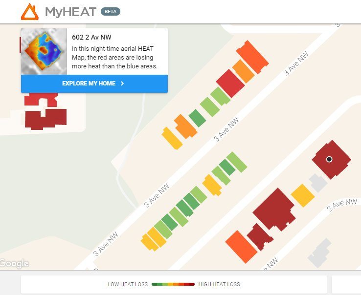
 

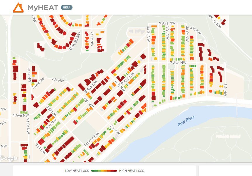
The MyHEAT platform gives the ability to visualize and compare the heat escaping from every building in a town or city, and is available free of charge. As of today the platform is live in Calgary, Okotoks, Airdrie, Edmonton, and Sherwood Park, with over 500,000 houses profiled. Additional Alberta communities will be added over the coming months, with a planned roll out across major urban Canadian cities over the next year.


In collaboration with ATCOenergy and Mike Holmes Inspections, today’s launch marks the continued commercialization of award-winning technology developed by Dr. Geoff Hay and his team at the University of Calgary. MyHEAT’s technology uses detailed nighttime thermal infrared airborne images to map building heat loss, and is based on proprietary algorithms that eliminate micro-climatic variability and geospatial effects. This increases the accuracy of building, community and city heat loss maps and makes it possible to compare the results over time and across different geographical locations.


Canada’s first urban heat loss map of over 500,000 homes


“This new technology is a prime example of Alberta leadership and innovation that will help reduce energy consumption and greenhouse gases, improve efficiency, and increase education and monitoring,” said Jeff Taylor, MyHEAT’s President and CEO, “We look forward to working with additional partners to build momentum towards a more sustainable future.”


About MyHEAT MyHEAT makes urban energy efficiency a reality for individuals, businesses and organizations. Our award-winning technology uses large-scale data processing that visually identifies where energy is escaping from buildings. The MyHEAT platform provides users with the information they need to understand their energy loss, increase efficiency, reduce consumption and save money. Our goal is to empower a worldwide reduction in urban greenhouse gas emissions, one building at a time. We have a passion for reducing greenhouse gas emissions and a commitment to innovation. See the MyHEAT platform in action at www.myheat.ca.


For more information, please contact:


Jeff Taylor, President and CEO MyHEAT Inc.


Email: jeff@myheat.ca

Share this entry
  • Share on Facebook
  • Share on Twitter
  • Share on Google+
  • Share on Pinterest
  • Share on Linkedin
  • Share on Tumblr
  • Share on Vk
  • Share on Reddit
  • Share by Mail
Generic selectors
Exact matches only
Search in title
Search in content
Search in posts
Search in pages
Filter by Categories
About
Canadian Geomatics Industry
Canadian GIS Jobs
Canadian Maps
College Programs
Conferences
Data & Software
Drone - UAV Aerial Views
Free Data & Software
Geo Books
Geo Industry News
Geomatics Careers and Jobs
Geomatics Conference & Events
Geospatial Resources
GIS & Geomatics Education
GIS tools
Historic Cartography
Multimedia
Online Education
Online Resources
Open Data
Other
Professional Groups and Organizations
Site Info
Social Media
University Programs
Web Mapping

More results ...


Find Canadian GIS jobs and add your geomatics resume for free
Support the The Royal Canadian Geographical Society


Followon TwitterSubscribeto RSS Feed

Canadian GIS Education Programs

  • York University - Vari HallYork University – GIS and Remote SensingJune 2, 2017 - 2:53 pm
  • University of WinnipegUniversity of Winnipeg – Red River College GIS ProgramFebruary 22, 2017 - 6:54 pm
  • Niagara CollegeNiagara CollegeDecember 1, 2016 - 8:56 am

Browse more Canadian GIS Education Programs

Contribute Canadian GIS Information, Education Program, Open Data or any other Canadian Geospatial related Info

Latest Geomatics Sector News, Events, Geo Books and more

  • Explore the Sights and Tastes of Canada with the RCGS at Vancouver’Explore the Sights and Tastes of Canada in support of GeographyApril 19, 2018 - 10:16 pm
  • Geomatics - remote sensingGAF Continues to Provide Ocean Color Data to ESAApril 16, 2018 - 7:49 am
  • 3d model mapGEO Jobe Welcomes New Jr. Application DeveloperApril 4, 2018 - 5:38 pm
  • Geomatics NetworkingNovara GeoSolutions Welcomes new Quality Assurance AnalystApril 1, 2018 - 10:37 pm

Browse all Canadian GIS & Geomatics news

Submit a Press Release

Latest GIS maps, Geomatics Data, geospatial resources and much more

  • download Canada LiDAR data freeCanadian LiDAR DataApril 11, 2018 - 7:41 am
  • Online GIS for Local GovernmentOnline GIS for Local GovernmentMarch 20, 2018 - 7:36 pm
  • Satellite Image Analysis and Terrain Modelling - A practical manual for natural resource management, disaster risk and development planning using free geospatial data and softwareSatellite Image Analysis and Terrain ModellingMarch 19, 2018 - 7:52 pm
  • History of Canada in 10 MapsHistory of Canada in 10 MapsFebruary 5, 2018 - 11:55 pm

Browse 100+ sources of Canadian Data

Browse & download Canadian Maps

© Copyright - Canadian GIS & Geomatics
  • Facebook
  • Twitter
  • Linkedin
  • Gplus
  • Mail
  • Pinterest
  • Rss
  • Home
  • Privacy Policy
  • Terms of Use
  • Contact Us
Antipodes Maps Antipodes Maps GIS-Pro 2016 GIS-Pro 2016 – URISA’s 54th Annual Conference
Scroll to top