GIS Tracking Technology Shines in the Light of Healthcare History
GIS Tracking Technology Shines in the Light of Healthcare History
It’s universally known that technology has changed the medical field forever. Even a trip to a rural doctor’s office reveals equipment the patient could see in any major city. This awareness has helped the general public to finally become aware of the skill levels possessed by care providers. For generations, most people not in the field assumed that a neighbor with an associate degree in nursing simply changed bedpans and took temperatures. Today, however, both nurses and doctors are directly involved in using Geographic Information Systems (GIS) to protect the public from some potentially lethal threats. Nearly a century ago, this wasn’t the case.
The Stakes
 In 1918, several soldiers at what is now Fort Riley, Kansas reported sick with what at first appeared to be routine flu symptoms. No one knew at the time, but these soldiers were the first of tens of millions worldwide who would contract a newly evolved strain of influenza. Over the next fifteen months, at least 50 million humans perished as a result of the fast spreading, quick killing pathogen. The name of the pandemic itself, the Spanish Influenza, illustrates today how the lack of accurate geographic tracking was a major factor in the worldwide death toll.
Scholars have since pinned down the initial outbreak as having begun at Fort Riley and then spread rapidly by soldiers moving from training camps to what would soon become occupation duty in Europe. From ships, train stations, military bases and ports across the globe, the virus spread, mutated and spread again, being recognized as a pandemic only after it has established itself in Spain, by no means the location of patient zero.
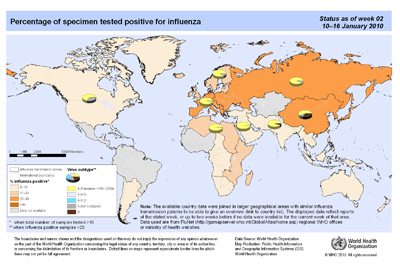
Desperate health officials in the United States Army led the American effort to track and contain the epidemic. Despite truly heroic efforts, the influenza mutated once again, only then becoming misleadingly dormant for decades. In 2009, another potentially catastrophic flu pandemic was identified. By then, however, GIS was a part of the World Health Organization’s arsenal to prevent the carnage of 1918-1920.
A Step Ahead of a Killer
Officially known as the H1N1 flu, though colloquially called Swine Flu, the virus spread virtually worldwide during its roughly year and a half emergence. Unlike its deadly counterpart of the early 20th Century, medical personnel were able to track outbreaks worldwide, buying time enough to employ defenses such as school and other closings to mitigate the spread of the virus and the implementation of mass vaccinations. Nurses and doctors were, from the very start of the flu breakout, a computer click away from up-to-date information from the World Health Organization and national health departments on where the spreading was occurring, if the virus had mutated and how best to respond.

Armed with first-rate information provided and by GIS tracking technology, nurses went into communities and educated officials and ordinary citizens about the facts about the virus. The relatively low death rate – over 25,000, including 428 Canadian citizens [http://en.wikipedia.org/wiki/2009_flu_pandemic_in_Canada] – led to calls of “overkill” on the part of the health community, a conclusion that may well have been a luxury provided by technology at the front lines of a war contained.
Dichotomy of Success
That such an impression of overblown responses seems to defy the knowledge of what havoc an unchecked pandemic can wreak may be, in part, due to the high degree of success provided by GIS and the medical community. But as more and more GIS devices are used to save lives on smaller scales, the value of such technology may be best seen by less than global standards. With future generations of nursing and medical doctors sure to learn how to use GIS technology with the same degree of skill as they use their stethoscope, recognition of its importance is assured. Among the teams of professionals called upon to thwart the lethality of the next major health threat, nurses and doctors will be joined by those in the geomatics field as they fight real killers.
About the author: Lindsey Paco is a freelance author who writes about career search strategies and social media. She lives in the Indianapolis area where she enjoys cycling. [http://www.coloradotech.edu/Degree-Programs/Associate-Degree-In-Nursing]


Leave a Reply
Want to join the discussion?Feel free to contribute!