New Pathway to a GIS Master’s Degree for Fleming College Graduates
/
0 Comments
Fleming College graduates now have the option of completing a master’s degree at Vancouver Island University (VIU) – the first pathway of its kind for the college.
VIU and Fleming have signed an agreement that allows eligible graduates of Fleming’s Geographic Information Systems (GIS) programs to enter the second year of VIU’s Master of GIS Applications program (MGISA).
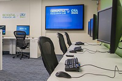
GIS Training at Colleges and Universities
Our ever evolving Geomatics industry has lead to increased demands for specialized GIS training, and Canada has remained on top of the leading GIS education providers for many years. Here are some of the best Colleges and Universities that offer GIS related programs. This page was created on the site a number of years back to highlight some of the best Colleges and Universities in Canada that offer GIS related programs.
Algonquin College GIS Graduate Certificate
The Geographic Information Systems certificate program offered through the School of Advanced Technology at Algonquin helps to provide students with a solid background in GIS technology, cartography, remote sensing, and web GIS application customization.
Okanagan College Advanced GIS Certificate
With the Advanced GIS Certificate program students learn the essentials of using GIS to create detailed maps, edit and manage spatial data and manage geographic based projects. More advanced topics include raster analysis, working with 3D data, and how to use GPS to collect data and perform spatial analysis.
A blend of theory and practical application are combined to ensure that graduates are prepared to enter the work force in a variety of different employment opportunities.

Durham College GIS Certificate
Durham College of Applied Arts and Technology is located in the Durham Region of Ontario. The Durham College GIS Certificate program is designed for students who want to develop skills and knowledge appropriate for entry level positions.
Sault College of Applied Technology
The post-graduate certificate program from Sault College has been known to prepare students for a solid career in geomatics through the integration of industry practiced GIS and remote sensing techniques.
A strong emphasis is placed on teaching the fundamentals and theory of GIS with a focus on hands-on training. Courses provide practical experiences in the use of ArcGIS, ENVI, PCI Geomatica, MS Access, MS Project and other industry standard software products.
Advanced Diploma in GIS Applications – Vancouver Island University
VIU's Advanced Diploma in GIS Applications (ADGISA)is offered both with either an In-Class or a fully Online version. In both options, students learn how to use GIS as spatial information and problem-solving tools in addressing real world problems.

College of the North Atlantic
The College of the North Atlantic Geomatics program deals with all aspects of Geomatics, including GIS, GPS and field training with state of the art surveying instrumentation and Geomatics software. In addition to theoretical instruction, students obtain considerable field and office experience through a combination of labs, field camps, and work terms.

Niagara College
At Niagara College they combine GIS, remote sensing and geodatabase management together throughout the three terms. The one year GIS Certificate program at Niagara on the Lake Campus includes a thesis project that students work on for the whole term while working along side with employers to help design and implement real world GIS projects.

