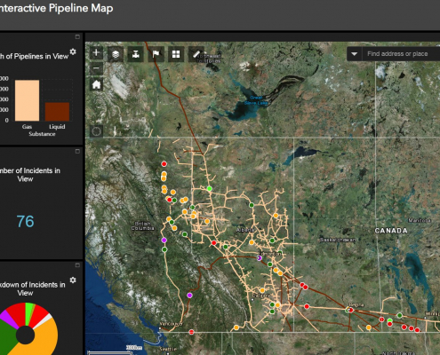
Canada has a vast network of pipelines that transport millions of litres of oil and gas every day. With this interactive mapping application, Canadians can easily identify where pipelines are located and find important related safety information.
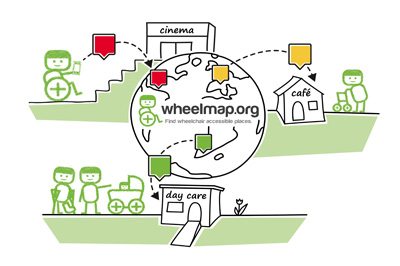
Wheelmap is an online mapping application by a German non-profit association, to help promote wheelchair accessible places (currently more than 550,000 points of interests in eighteen different languages have been added) and allow people to find out if a location is accessible or not.
It is also hoped that with public awareness raised through the use of Wheelmap, that more owners of public buildings will be encouraged to improve their location’s accessibility.
Online Web mapping involves designing, implementing, generating and delivering maps to end users via the Internet through common web browsers, allowing people to use maps interactively with out needing high end software. Our Web mapping section examines the various online web mapping and web GIS applications that have been created all across Canada. If you know of one that is not listed on the site then let us know and we will see that it is added, just use the form on this page to send us the details.
https://canadiangis.com/wp-content/uploads/Maps-Bing-vs-Google2.jpg257600CanadianGIShttps://canadiangis.com/wp-content/uploads/CanadianGIS-rec-logo-2021-v4.pngCanadianGIS2013-01-03 01:44:512013-01-03 01:44:51Submit an Online Web Mapping Site

 https://canadiangis.com/wp-content/uploads/Interactive-Pipeline-Map.jpg
990
1405
CanadianGIS
https://canadiangis.com/wp-content/uploads/CanadianGIS-rec-logo-2021-v4.png
CanadianGIS2019-01-21 11:45:532019-01-21 11:45:53Interactive Pipeline Map
 https://canadiangis.com/wp-content/uploads/Wheelmap-worldwide.jpg
266
400
CanadianGIS
https://canadiangis.com/wp-content/uploads/CanadianGIS-rec-logo-2021-v4.png
CanadianGIS2016-01-07 09:51:442016-01-07 09:51:44Wheelmap – Wheelchair Accessible Maps
 https://canadiangis.com/wp-content/uploads/Maps-Bing-vs-Google2.jpg
257
600
CanadianGIS
https://canadiangis.com/wp-content/uploads/CanadianGIS-rec-logo-2021-v4.png
CanadianGIS2013-01-03 01:44:512013-01-03 01:44:51Submit an Online Web Mapping Site