Posts

Canadian Open Data and Free Geospatial Data
/
23 Comments
Over the past few years CanadianGIS.com has been highlighting and promoting various cities and provinces in Canada that have done a great job providing data and applications to the public.
We created this page a few years ago to collaborate links of all the open geospatial data info (sites that offer data downloads at no cost and without restrictions), fee based geospatial data, online web mapping applications and other great sources of geospatial information (including National, Provincial and Regional levels).
This comprehensive list of open geospatial data, fee based geospatial data, web mapping applications and cartographic products is a valuable asset to many people (... we get hundreds of emails and requests regarding "Where can I find data for ...?") so we continue to update it with new information and sources of Canadian data sets.

Newfoundland and Labrador OpenData
Looking for data sets featuring Newfoundland and Labrador? Then you should check out the Newfoundland and Labrador OpenData. They are providing data in various accessible formats numerical tabular styled files as well as common text formats.

New and Improved GeoGratis Website
Natural Resources Canada (NRCan) has recently launched a new update to the already innovative GeoGratis website.
GeoGratis is a web portal that provides access to a wide collection of Canadian geospatial data, maps, images, and publications at no cost and without restrictions. All distributed data accessed via GeoGratis comes with an Unrestricted Use Licence Agreement that grants users a non-exclusive, royalty-free right and licence to exercise all intellectual property rights in the data including the right to use, incorporate, sub-license, modify, further develop, and distribute the data.
Improvements to the new site made go much deeper then just minor cosmetic changes; the site is now easier to use and allows access to better search tools where one can now view and download all available geospatial data sets consolidated into the same web site. The new Platform also now better supports developers that want to create unique and innovative mapping applications with Canadian data, images and documents using one of the three available GeoGratis Application Programming Interfaces (API’s).

Free Georeferenced Topographic Map Sheets
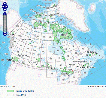
So far this year Natural Resources Canada has released over 350 updated or new topographic map sheets and made them available to the public in what they refer to as the CanTopo series. CanTopo is considered the next generation of topographic map sheets that provides quality spatial information that fully complies with international geomatic standards.
The digital maps are considered multipurpose because they can be utilized for a wide range of uses from many different organizations and individuals. Georeferenced versions can also be used with Global Positioning System (GPS) receivers and other digital geographic data sets with various software packages such as Google Earth, ArcMap or Global Mapper. You can also simply print them and use them the way they are, as regular NTS paper maps, just like most of done for years.

Free Canadian Geospatial Data Sets
The Federal Government produces and acquires data sets in many different areas including health, agriculture, the environment and natural resources. The Government of Canada launched an open data portal [data.gc.ca] earlier this year as part of Canada's open government initiative. The portal aims to provide Canadians with a single point of access to find and download government open data sets.
