Posts
![World Shaded Relief KMZ file [free download] World Shaded Relief Map](https://canadiangis.com/wp-content/uploads/World-Shaded-Relief-Map-1-495x400.jpg)
World Shaded Relief KMZ file [free download]
/
0 Comments
This handy color shaded relief map of the world including oceans was created from the NOAA ETOPO1 data set and was intended to be used with handheld Garmin GPS units, but can also make a nice colorful back ground image to use in Google Earth. Find out how to download this free resource ...

Canadian Open Data and Free Geospatial Data
Over the past few years CanadianGIS.com has been highlighting and promoting various cities and provinces in Canada that have done a great job providing data and applications to the public.
We created this page a few years ago to collaborate links of all the open geospatial data info (sites that offer data downloads at no cost and without restrictions), fee based geospatial data, online web mapping applications and other great sources of geospatial information (including National, Provincial and Regional levels).
This comprehensive list of open geospatial data, fee based geospatial data, web mapping applications and cartographic products is a valuable asset to many people (... we get hundreds of emails and requests regarding "Where can I find data for ...?") so we continue to update it with new information and sources of Canadian data sets.

GIS Formats and Geospatial File Extensions
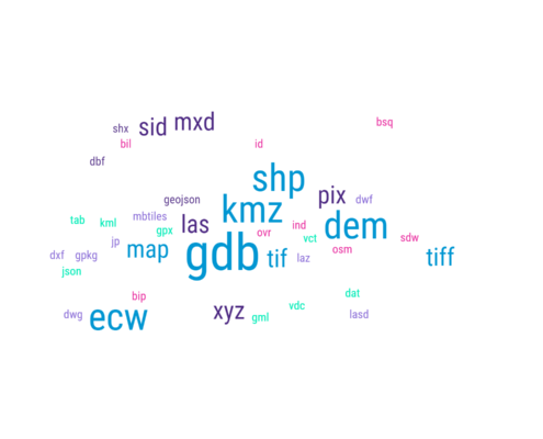
Geographic Information Systems (GIS) formats are specialized file types created to store and organize geographic data, including maps, databases, images, and other types of spatial data. These formats usually contain details about the geographic features’ location, shape, and characteristics, and can be utilized for various purposes, for example, mapping, analysis, and visualization. Encountering unfamiliar GIS formats or geospatial file extensions can be a daunting task for professionals, especially with the constant evolution of the geomatics sector. With various commercial and open-source software tools readily available to the geospatial community, it is common to come across new formats and extensions that one may not be familiar with. To assist in this ...

Google’s Dataset Search Tool
To help provide better access to open data, Google has launched a beta version of their Dataset Search tool, so that the geospatial community can discover the data they need for their projects

Free GIS Day Promotion Resources
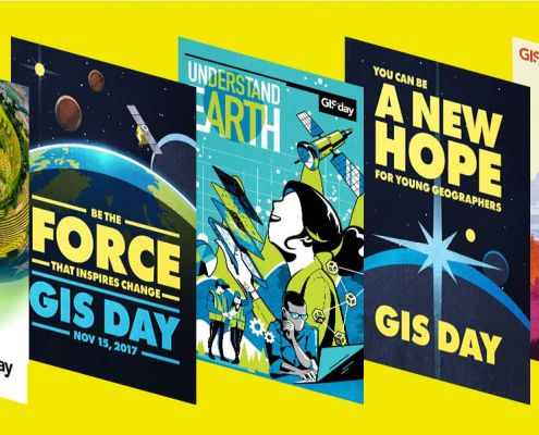
GIS Day provides a forum for GIS users all over the world to demonstrate how real-world applications are making a difference in society. This year GIS day is Wednesday, November 13, 2019.
Download free resources provided to help you put together a fun and successful GIS Day event ...

Interactive Pipeline Map
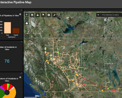
Canada has a vast network of pipelines that transport millions of litres of oil and gas every day. With this interactive mapping application, Canadians can easily identify where pipelines are located and find important related safety information.

Newfoundland and Labrador OpenData
Looking for data sets featuring Newfoundland and Labrador? Then you should check out the Newfoundland and Labrador OpenData. They are providing data in various accessible formats numerical tabular styled files as well as common text formats.

OpenStreetMap Step by Step User Guides
If you have been following our OpenStreetMap topic over the past few months then I am sure you have come to the realize that it is a community driven project and that anyone can edit OpenStreetMaps. But where does one start?
Here are some free user guides to help you get started using OpenStreetMap.

Bathymetry of Lake Ontario
Bathymetry is used to measure water depths to help model physical underwater terrain found beneath large bodies of water. Similar to the same way that LiDAR models are represent 3D features (or relief) of land terrain, bathymetric maps illustrate the terrain or land that is located under large bodies of water.
Download Bathymetry of Lake Ontario pre-made maps and GIS data ...
