Posts

Submit an Online Web Mapping Site
Submit an Online Web Mapping Site

Online Web mapping involves designing, implementing, generating and delivering maps to end users via the Internet through common web browsers, allowing people to use maps interactively with out needing high end software. Our Web mapping section examines the various online web mapping and web GIS applications that have been created all across Canada. If you know of one that is not listed on the site then let us know and we will see that it is added, just use the form on this page to send us the details.
Things to See abd Do in British Columbia

Town of Banff Online Maps and Apps

/
As many of you already know or perhaps may have recently discovered, CanadianGIS.com has been high-lighting places in Canada that have an online web mapping site or application in order to help better provide information to their residents. Now this month the Town of Banff is featured as they too have now joined the spatial ranks of several other Cities and Municipalities in Canada with the launch of their own online mapping site (Simply check out the Web Maps category link or the site search tools along the right side to find many other great Canadian Online Map sites featured). The Maps and Apps website created by the Town of Banff GIS and IT departments provides free public access to maps and geospatial applications that help the Town of Banff provide better services and connect with it's own citizens in a new way.
Things to See abd Do in British Columbia

British Columbia’s DataBC program

/
The DataBC program provides public access to provincial geographic information through a single web interface, offering a multitude of geographic data (spatial and no-spatial), applications and tools in order to help their citizens make better informed decisions, inspire change and encourage development of new ideas to improve government decision making & policies. They have provided minimal licensing requirements to their data to help broaden the use of the Province's assets. "You can use our geographic services to help map the data and find tools to help you conduct your own research, analyze statistics, develop apps or to simply satisfy your curiosity."
BC mountains

City of Prince George online PGMap Application

/
The City of Prince George has released an updated version of their PGMap online web mapping Application. PGMap is what they refer to as the "On-line Geographic Information System" for the City of Prince George, British Columbia. PGMap was created and is provided free of charge to the public to use for viewing and searching property boundaries, aerial photography, legal descriptions, parcel information, verify zoning and various other City boundaries.
GeoGeeks Fraser Valley Group

GeoGeeks Fraser Valley Group

/

The GeoGeeks Fraser Valley Group is for those interested in spatial related things and for those who are interested in sharing that passion with others through spatial technology. There is so much that cab be learned and shared from one another: open data, open street mapping, open source software, new technology and techniques, and more. So if you are in the Fraser Valley area then you should get together, network and support one other!

Simon Fraser University GIS

Simon Fraser University Bachelor of Science GIS
/
SFU offrs a Certificate in Spatial Information Systems (SIS) program comprised of nine undergraduate level courses and also a Bachelor of Science in GIS program. The SFU state of the art geography facility has allowed students to adapt to the growing industry and are exceptionally well qualified to contribute to a rapidly growing industry.
British Columbia Court Services Locator Map

British Columbia Court Services Locator Map

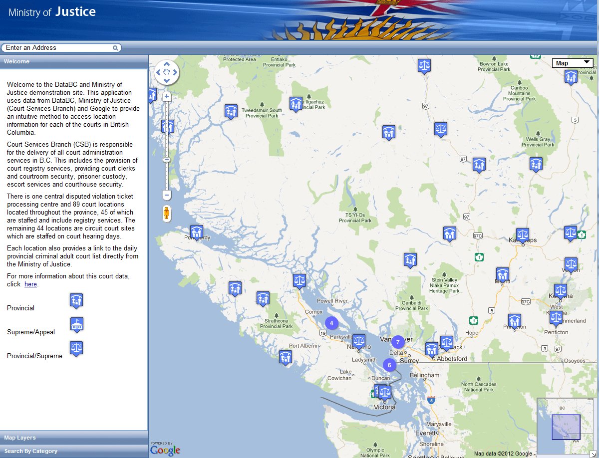
DataBC and the Ministry of Justice have joined forces to provide an online mapping application to help the people of British Columbia be able to spatially locate where the various court facilities in British Columbia are located. The interactive mapping tool based on the Google Maps platform uses data from uses data from DataBC and Ministry of Justice (Court Services Branch) to provide people with a new way of accessing location information for courts in British Columbia.Thier interactive mapping tool offers various search abilities and provides the locations of courts in the map window that when clicked, prodding basic information and links to the respective web pages for that facility with more adequate information.
Things to See abd Do in British Columbia

Things to See & Do in British Columbia

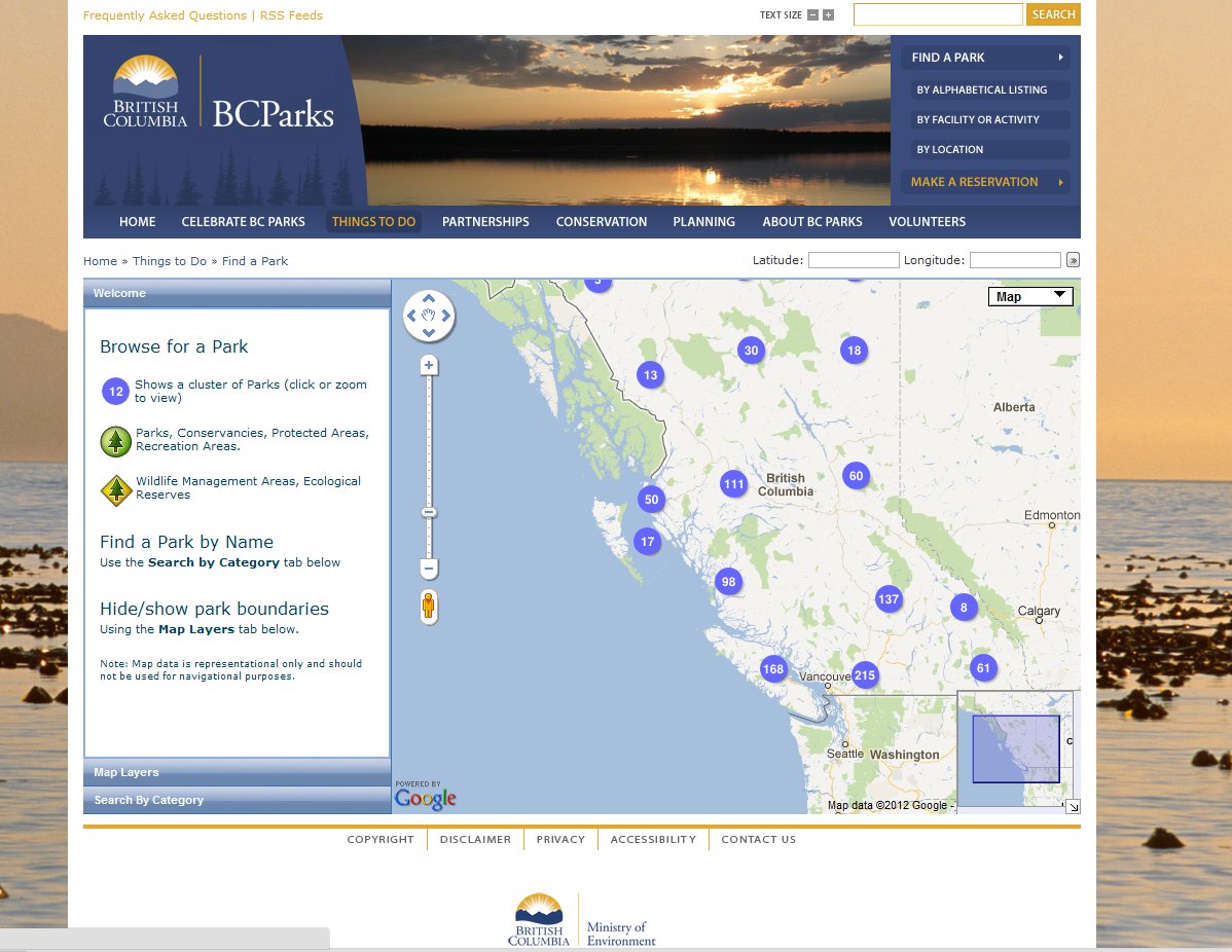
BCParks has created a simple online mapping application with data from the DataBC program to help people in British Columbia find things see and do in British Columbia by identifying the various locations of the Province's Parks, Protected Areas, Recreation Areas and Ecological Reserves. The online interactive mapping tool based on the Google Maps platform offers various searching abilities and provides users with some control over the features and map layers that are displayed in the mapping window. This online map application is ...
Things to See abd Do in British Columbia

Canadian Geomatics Company Directory

/

Our GIS Company Directory contains information about the various Geomatics related companies found in Canada including many key aspects such as the companies basic info, contact info, web site info and geographic location. To find a GIS related Company listing on our site, simply select a province from the list found here to find a Geomatics related company in that region, or use any of simple search tools found through out the site that will allow you to search by company names, Cities and or postal code.