Geospatial data and software are used to collect, analyze and interpret geographic information. Geomatics is the science of collecting, storing, analyzing and interpreting spatial data. Geospatial data can be used in a variety of applications such as mapping, surveying, navigation, land use planning, environmental monitoring, and resource management.
Geomatics data and software are used in industries such as agriculture, forestry, engineering, urban planning, oil and gas, and mining. Geomatics software includes Geographic Information Systems (GIS), satellite imagery, surveying and mapping software, and other specialized applications. The combination of these technologies allow for efficient and accurate data collection and analysis, as wellcan be used to help identify trends and patterns in the environment, track the movement of animals and natural resources, and monitor the health of ecosystems. Geomatics data and software are essential for understanding and managing the Earth‘s resources.
The “Geospatial Data and Software” section of our site includes information related to a wide array of geospatial data and software related topics. See the various pages listed further below for more information …
The most complete geographical representation ever created of Mi’kma’ki territory and Mi’kmaw Place Names, including an online interactive map with more than 700 place names derived from approximately 1500 names collected throughout Nova Scotia from interviews with Mi’kmaw Elders and others. Click here to browse the Atlas of Mi’kmaw Place Names ...
https://canadiangis.com/wp-content/uploads/Atlas-of-Mikmaw-Place-Names.png266400tmackinnonhttps://canadiangis.com/wp-content/uploads/CanadianGIS-rec-logo-2021-v4.pngtmackinnon2020-10-30 19:43:562023-05-16 16:23:17Atlas of Mi’kmaw Place Names
Join us virtually this year for Canada’s National Geospatial Leadership: GeoIgnite conference on July 22nd to 24th, 2020!
GeoIgnite is a unique opportunity for geospatial community in Canada and abroad to learn, share and engage with one another at our virtual conference.
https://canadiangis.com/wp-content/uploads/unnamed-1024x512-1.jpg5121024tmackinnonhttps://canadiangis.com/wp-content/uploads/CanadianGIS-rec-logo-2021-v4.pngtmackinnon2020-07-08 19:39:512020-07-08 19:43:14GeoIgnite: Leadership in Times of Disruption
The 1898 Vancouver Panoramic Map provides an oblique look at the City of Vancouver looking from the north. There are also pictorial representations of buildings, industrial activity, various boats and vegetation. Streets, names of buildings and businesses are labeled, as well as the locations of the City foundry, machine works and more. Check out this historic look at Vancouver ...
https://canadiangis.com/wp-content/uploads/1898-Vancouver-Panoramic-scaled.jpg18472560tmackinnonhttps://canadiangis.com/wp-content/uploads/CanadianGIS-rec-logo-2021-v4.pngtmackinnon2020-01-13 17:00:192020-01-14 10:23:311898 Vancouver Panoramic Map
The Canadian Geospatial Data Extraction tool is a handy resource that allows users to extract seamless geospatial open data based on specific user-defined geographic area and data options
https://canadiangis.com/wp-content/uploads/Canadian-Geospatial-Data-Extraction-Tool.png10831851tmackinnonhttps://canadiangis.com/wp-content/uploads/CanadianGIS-rec-logo-2021-v4.pngtmackinnon2019-12-05 14:51:112019-12-04 10:57:24Canadian Geospatial Data Extraction Tool
In Canada close to 30,000 official place names are of Indigenous origin, this story map provides a small sample of the official Indigenous Place Names from the Geographical Names Board of Canada.
https://canadiangis.com/wp-content/uploads/Indigenous-Place-Names-in-Canada.png11252000tmackinnonhttps://canadiangis.com/wp-content/uploads/CanadianGIS-rec-logo-2021-v4.pngtmackinnon2019-11-15 12:12:092019-12-11 14:21:48Stories from the Land: Indigenous Place Names in Canada
Geography is increasingly being recognized as a critically important element. Take free GIS courses online to build your skills and advance your career using open-source software.
https://canadiangis.com/wp-content/uploads/free_course-archaeology2.png295516tmackinnonhttps://canadiangis.com/wp-content/uploads/CanadianGIS-rec-logo-2021-v4.pngtmackinnon2019-09-15 15:33:522019-09-14 15:55:50Learning GIS with free online courses and open source
Natural Resources Canada (NRCan) has recently produced a new release of the High Resolution Digital Elevation Model (HRDEM) product for the entire Canadian Arctic and made it available to download from the Open Government Portal. It allows ...
https://canadiangis.com/wp-content/uploads/HRDEM-coverage-map-as-of-August-2019.png10871240tmackinnonhttps://canadiangis.com/wp-content/uploads/CanadianGIS-rec-logo-2021-v4.pngtmackinnon2019-09-04 09:56:082019-09-16 16:04:00Canadian Arctic High Resolution Digital Elevation Model
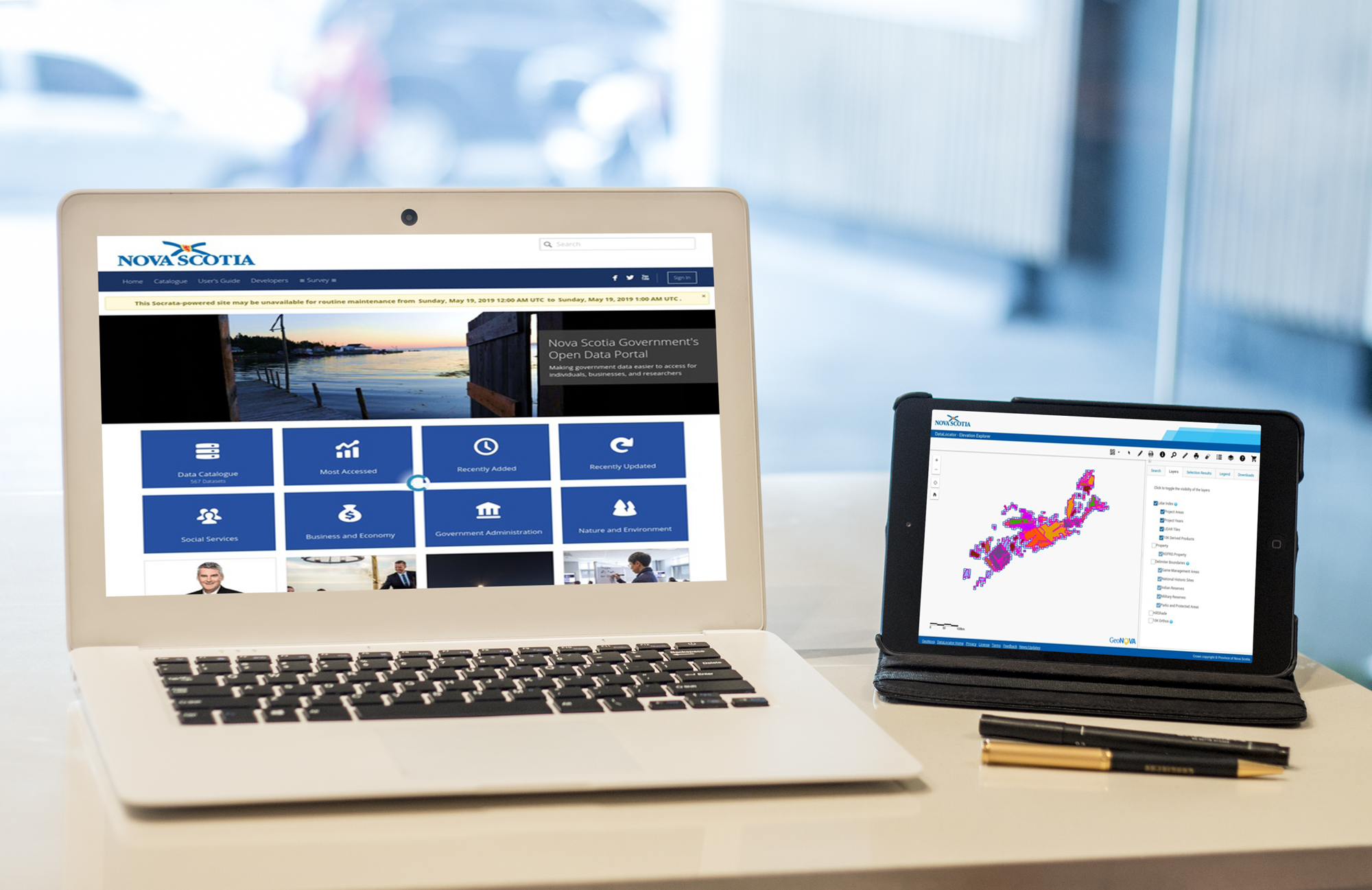
On this page we maintain a dynamic growing list of sources where you can download Nova Scotia open data and related Nova Scotia geospatial data to use in GIS applications ...
https://canadiangis.com/wp-content/uploads/Sources-of-Nova-Scotia-Free-Geospatial-Data.jpg17112594tmackinnonhttps://canadiangis.com/wp-content/uploads/CanadianGIS-rec-logo-2021-v4.pngtmackinnon2019-07-16 10:10:202019-07-16 10:13:15Sources of Nova Scotia Geospatial Data
This 1895 Ottawa panoramic map provides viewers an oblique aerial view in a south direction from the east looking west up the Ottawa river. It contains detailed sketches of several principal business buildings at that time, that are displayed around the edges of the map. You also get a look at the transit rail system and a view of Parliament Hill before the big fire in 1916. Find out how to get a high resolution copy of this historic map ....
 Ge
Ge https://canadiangis.com/wp-content/uploads/Atlas-of-Mikmaw-Place-Names.png
266
400
tmackinnon
https://canadiangis.com/wp-content/uploads/CanadianGIS-rec-logo-2021-v4.png
tmackinnon2020-10-30 19:43:562023-05-16 16:23:17Atlas of Mi’kmaw Place Names
https://canadiangis.com/wp-content/uploads/Atlas-of-Mikmaw-Place-Names.png
266
400
tmackinnon
https://canadiangis.com/wp-content/uploads/CanadianGIS-rec-logo-2021-v4.png
tmackinnon2020-10-30 19:43:562023-05-16 16:23:17Atlas of Mi’kmaw Place Names https://canadiangis.com/wp-content/uploads/unnamed-1024x512-1.jpg
512
1024
tmackinnon
https://canadiangis.com/wp-content/uploads/CanadianGIS-rec-logo-2021-v4.png
tmackinnon2020-07-08 19:39:512020-07-08 19:43:14GeoIgnite: Leadership in Times of Disruption
https://canadiangis.com/wp-content/uploads/unnamed-1024x512-1.jpg
512
1024
tmackinnon
https://canadiangis.com/wp-content/uploads/CanadianGIS-rec-logo-2021-v4.png
tmackinnon2020-07-08 19:39:512020-07-08 19:43:14GeoIgnite: Leadership in Times of Disruption https://canadiangis.com/wp-content/uploads/1898-Vancouver-Panoramic-scaled.jpg
1847
2560
tmackinnon
https://canadiangis.com/wp-content/uploads/CanadianGIS-rec-logo-2021-v4.png
tmackinnon2020-01-13 17:00:192020-01-14 10:23:311898 Vancouver Panoramic Map
https://canadiangis.com/wp-content/uploads/1898-Vancouver-Panoramic-scaled.jpg
1847
2560
tmackinnon
https://canadiangis.com/wp-content/uploads/CanadianGIS-rec-logo-2021-v4.png
tmackinnon2020-01-13 17:00:192020-01-14 10:23:311898 Vancouver Panoramic Map https://canadiangis.com/wp-content/uploads/Canadian-Geospatial-Data-Extraction-Tool.png
1083
1851
tmackinnon
https://canadiangis.com/wp-content/uploads/CanadianGIS-rec-logo-2021-v4.png
tmackinnon2019-12-05 14:51:112019-12-04 10:57:24Canadian Geospatial Data Extraction Tool
https://canadiangis.com/wp-content/uploads/Canadian-Geospatial-Data-Extraction-Tool.png
1083
1851
tmackinnon
https://canadiangis.com/wp-content/uploads/CanadianGIS-rec-logo-2021-v4.png
tmackinnon2019-12-05 14:51:112019-12-04 10:57:24Canadian Geospatial Data Extraction Tool https://canadiangis.com/wp-content/uploads/Indigenous-Place-Names-in-Canada.png
1125
2000
tmackinnon
https://canadiangis.com/wp-content/uploads/CanadianGIS-rec-logo-2021-v4.png
tmackinnon2019-11-15 12:12:092019-12-11 14:21:48Stories from the Land: Indigenous Place Names in Canada
https://canadiangis.com/wp-content/uploads/Indigenous-Place-Names-in-Canada.png
1125
2000
tmackinnon
https://canadiangis.com/wp-content/uploads/CanadianGIS-rec-logo-2021-v4.png
tmackinnon2019-11-15 12:12:092019-12-11 14:21:48Stories from the Land: Indigenous Place Names in Canada https://canadiangis.com/wp-content/uploads/free_course-archaeology2.png
295
516
tmackinnon
https://canadiangis.com/wp-content/uploads/CanadianGIS-rec-logo-2021-v4.png
tmackinnon2019-09-15 15:33:522019-09-14 15:55:50Learning GIS with free online courses and open source
https://canadiangis.com/wp-content/uploads/free_course-archaeology2.png
295
516
tmackinnon
https://canadiangis.com/wp-content/uploads/CanadianGIS-rec-logo-2021-v4.png
tmackinnon2019-09-15 15:33:522019-09-14 15:55:50Learning GIS with free online courses and open source https://canadiangis.com/wp-content/uploads/HRDEM-coverage-map-as-of-August-2019.png
1087
1240
tmackinnon
https://canadiangis.com/wp-content/uploads/CanadianGIS-rec-logo-2021-v4.png
tmackinnon2019-09-04 09:56:082019-09-16 16:04:00Canadian Arctic High Resolution Digital Elevation Model
https://canadiangis.com/wp-content/uploads/HRDEM-coverage-map-as-of-August-2019.png
1087
1240
tmackinnon
https://canadiangis.com/wp-content/uploads/CanadianGIS-rec-logo-2021-v4.png
tmackinnon2019-09-04 09:56:082019-09-16 16:04:00Canadian Arctic High Resolution Digital Elevation Model https://canadiangis.com/wp-content/uploads/Sources-of-Nova-Scotia-Free-Geospatial-Data.jpg
1711
2594
tmackinnon
https://canadiangis.com/wp-content/uploads/CanadianGIS-rec-logo-2021-v4.png
tmackinnon2019-07-16 10:10:202019-07-16 10:13:15Sources of Nova Scotia Geospatial Data
https://canadiangis.com/wp-content/uploads/Sources-of-Nova-Scotia-Free-Geospatial-Data.jpg
1711
2594
tmackinnon
https://canadiangis.com/wp-content/uploads/CanadianGIS-rec-logo-2021-v4.png
tmackinnon2019-07-16 10:10:202019-07-16 10:13:15Sources of Nova Scotia Geospatial Data https://canadiangis.com/wp-content/uploads/1895-Ottawa-Panoramic-Map.jpg
1220
1578
tmackinnon
https://canadiangis.com/wp-content/uploads/CanadianGIS-rec-logo-2021-v4.png
tmackinnon2019-06-21 08:17:122019-11-21 08:18:081895 Ottawa Panoramic Map
https://canadiangis.com/wp-content/uploads/1895-Ottawa-Panoramic-Map.jpg
1220
1578
tmackinnon
https://canadiangis.com/wp-content/uploads/CanadianGIS-rec-logo-2021-v4.png
tmackinnon2019-06-21 08:17:122019-11-21 08:18:081895 Ottawa Panoramic Map