Geospatial data and software are used to collect, analyze and interpret geographic information. Geomatics is the science of collecting, storing, analyzing and interpreting spatial data. Geospatial data can be used in a variety of applications such as mapping, surveying, navigation, land use planning, environmental monitoring, and resource management.
Geospatial data and software are used to Geomatics data and software are used in industries such as agriculture, forestry, engineering, urban planning, oil and gas, and mining. Geomatics software includes Geographic Information Systems (GIS), satellite imagery, surveying and mapping software, and other specialized applications. The combination of these technologies allow for efficient and accurate data collection and analysis, as well can be used to help identify trends and patterns in the environment, track the movement of animals and natural resources, and monitor the health of ecosystems. Geomatics data and software are essential for understanding and managing the Earth’s resources.
The “Geospatial Data and Software” section of our site includes information related to a wide array of geospatial data and software related topics. See the various pages listed further below for more information …
The National Hydro Network (NHN) is a seamless geospatial vector data set with attributes that represents Canada’s framework of inland surface waters. It was created from different databases as part of the GeoBase Surface Water Program, to help with flow analysis, watershed management, environmental and hydrographical applications, as well as a multitude of other cartographic applications.
https://canadiangis.com/wp-content/uploads/nhn_rhn_01ef000_en-scaled.jpg25602181CanadianGIShttps://canadiangis.com/wp-content/uploads/CanadianGIS-rec-logo-2021-v4.pngCanadianGIS2023-01-09 20:45:402023-01-09 20:45:40National Hydro Network (NHN) – Canadian Open Data
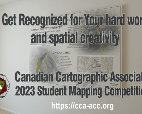
Every year the CCA announces awards, prizes and scholarships for Canadian post-secondary students involved in any forms of cartography or map-making. Find out how you could get some $$ for maps you create while at school!!!
https://canadiangis.com/wp-content/uploads/Canadian-Cartographic-Association-Student-Mapping-Competition-2023.png13782400CanadianGIShttps://canadiangis.com/wp-content/uploads/CanadianGIS-rec-logo-2021-v4.pngCanadianGIS2023-01-04 19:00:052023-01-04 19:00:05Canadian Cartographic Association Student Map Competition
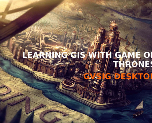
The ‘Learning GIS with Game of Thrones’ guide is aimed to encourage people to learn GIS with a user-friendly open source GIS software while having some fun ...
https://canadiangis.com/wp-content/uploads/GoT_book_GIS_gvSIG_Page_01.jpg12901996CanadianGIShttps://canadiangis.com/wp-content/uploads/CanadianGIS-rec-logo-2021-v4.pngCanadianGIS2022-12-14 18:56:272022-12-14 18:56:27Game of Thrones GIS Data and Maps
The new improved Nova Scotia Civic Address Finder is an online mapping application used to allow the public to view civic address information, including civic numbers, street names and more ...
https://canadiangis.com/wp-content/uploads/Nova-Scotia-Civic-Address-Finder.jpg9701755CanadianGIShttps://canadiangis.com/wp-content/uploads/CanadianGIS-rec-logo-2021-v4.pngCanadianGIS2022-12-02 09:00:242022-12-02 09:00:24Nova Scotia Civic Address Finder
A History of Canada in 10 Maps consists of several fascinating stories behind some of the people and maps that helped define Canada.
https://canadiangis.com/wp-content/uploads/History-of-Canada-in-10-Maps.png9391700CanadianGIShttps://canadiangis.com/wp-content/uploads/CanadianGIS-rec-logo-2021-v4.pngCanadianGIS2022-03-28 15:20:302026-06-26 10:24:04History of Canada in 10 Maps
Recently Nova Scotia joined the growing number of Canadian Provinces and Municipalities that offer open data, when it officially launched the Nova Scotia open data portal providing public access to more than 135 different data sets
Open Data is about drawing on the collective knowledge and innovation of Nova Scotians to help grow our economy and improve the lives of those around us ...
https://canadiangis.com/wp-content/uploads/Nova-Scotia-Open-Data-Portal.jpg266400CanadianGIShttps://canadiangis.com/wp-content/uploads/CanadianGIS-rec-logo-2021-v4.pngCanadianGIS2021-11-04 20:48:102021-11-04 20:48:10Nova Scotia Open Data Portal
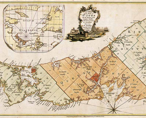
Historic Maps of Prince Edward Island that you can download include ...
https://canadiangis.com/wp-content/uploads/Historic-Map-Prince-Edward-Island-.jpg6391216CanadianGIShttps://canadiangis.com/wp-content/uploads/CanadianGIS-rec-logo-2021-v4.pngCanadianGIS2021-07-30 13:00:152021-07-30 13:00:15Historic Maps of Prince Edward Island
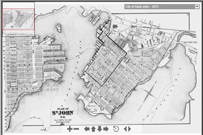
The Saint John maps collection includes an interactive atlas from 1875, compiled from official hand drawn plans and surveys. You will also find an interactive map of Historic Coastline and Fortifications and scanned copies of Murdoch-Lingley Survey Plans from 1920. Find out how you can download and use maps and images from the Saint John Historical Maps collection ...
https://canadiangis.com/wp-content/uploads/City-of-Saint-John-Maps-Plans-and-Historical-Data.jpg266400CanadianGIShttps://canadiangis.com/wp-content/uploads/CanadianGIS-rec-logo-2021-v4.pngCanadianGIS2021-05-04 14:14:132021-05-04 14:14:13City of Saint John Maps, Plans and Historical Data
Download Google Earth Pro, a free virtual 3D mapping & geographical information software. It has become one of the key elements over the past few years that has helped people become more aware of the geomatics industry. Find out how you can download Google Earth Pro for free ...
https://canadiangis.com/wp-content/uploads/Google-Earth-Pro1.jpg266400CanadianGIShttps://canadiangis.com/wp-content/uploads/CanadianGIS-rec-logo-2021-v4.pngCanadianGIS2021-04-29 15:22:032021-04-29 15:22:03Download Google Earth Pro for Free
The National Road Network (NRN) is a seamless geospatial vector data containing Canadian road phenomena that provides access to over 1 million kilometres of up-to-date centerline road network data.
https://canadiangis.com/wp-content/uploads/NRN-shapefile.jpg9881740CanadianGIShttps://canadiangis.com/wp-content/uploads/CanadianGIS-rec-logo-2021-v4.pngCanadianGIS2021-03-01 08:51:382021-03-01 08:51:38National Road Network (NRN) – Canadian Open Data


 https://canadiangis.com/wp-content/uploads/nhn_rhn_01ef000_en-scaled.jpg
2560
2181
CanadianGIS
https://canadiangis.com/wp-content/uploads/CanadianGIS-rec-logo-2021-v4.png
CanadianGIS2023-01-09 20:45:402023-01-09 20:45:40National Hydro Network (NHN) – Canadian Open Data
 https://canadiangis.com/wp-content/uploads/Canadian-Cartographic-Association-Student-Mapping-Competition-2023.png
1378
2400
CanadianGIS
https://canadiangis.com/wp-content/uploads/CanadianGIS-rec-logo-2021-v4.png
CanadianGIS2023-01-04 19:00:052023-01-04 19:00:05Canadian Cartographic Association Student Map Competition
 https://canadiangis.com/wp-content/uploads/GoT_book_GIS_gvSIG_Page_01.jpg
1290
1996
CanadianGIS
https://canadiangis.com/wp-content/uploads/CanadianGIS-rec-logo-2021-v4.png
CanadianGIS2022-12-14 18:56:272022-12-14 18:56:27Game of Thrones GIS Data and Maps
 https://canadiangis.com/wp-content/uploads/Nova-Scotia-Civic-Address-Finder.jpg
970
1755
CanadianGIS
https://canadiangis.com/wp-content/uploads/CanadianGIS-rec-logo-2021-v4.png
CanadianGIS2022-12-02 09:00:242022-12-02 09:00:24Nova Scotia Civic Address Finder
 https://canadiangis.com/wp-content/uploads/History-of-Canada-in-10-Maps.png
939
1700
CanadianGIS
https://canadiangis.com/wp-content/uploads/CanadianGIS-rec-logo-2021-v4.png
CanadianGIS2022-03-28 15:20:302026-06-26 10:24:04History of Canada in 10 Maps
 https://canadiangis.com/wp-content/uploads/Nova-Scotia-Open-Data-Portal.jpg
266
400
CanadianGIS
https://canadiangis.com/wp-content/uploads/CanadianGIS-rec-logo-2021-v4.png
CanadianGIS2021-11-04 20:48:102021-11-04 20:48:10Nova Scotia Open Data Portal
 https://canadiangis.com/wp-content/uploads/Historic-Map-Prince-Edward-Island-.jpg
639
1216
CanadianGIS
https://canadiangis.com/wp-content/uploads/CanadianGIS-rec-logo-2021-v4.png
CanadianGIS2021-07-30 13:00:152021-07-30 13:00:15Historic Maps of Prince Edward Island
 https://canadiangis.com/wp-content/uploads/City-of-Saint-John-Maps-Plans-and-Historical-Data.jpg
266
400
CanadianGIS
https://canadiangis.com/wp-content/uploads/CanadianGIS-rec-logo-2021-v4.png
CanadianGIS2021-05-04 14:14:132021-05-04 14:14:13City of Saint John Maps, Plans and Historical Data
 https://canadiangis.com/wp-content/uploads/Google-Earth-Pro1.jpg
266
400
CanadianGIS
https://canadiangis.com/wp-content/uploads/CanadianGIS-rec-logo-2021-v4.png
CanadianGIS2021-04-29 15:22:032021-04-29 15:22:03Download Google Earth Pro for Free
 https://canadiangis.com/wp-content/uploads/NRN-shapefile.jpg
988
1740
CanadianGIS
https://canadiangis.com/wp-content/uploads/CanadianGIS-rec-logo-2021-v4.png
CanadianGIS2021-03-01 08:51:382021-03-01 08:51:38National Road Network (NRN) – Canadian Open Data