5 Most Viewed UAVs for Mapping and 3D Modelling
/
2 Comments
Geo-matching.com features a selection of the latest and most important geomatics equipment, including UAS for Mapping and 3D Modelling. There service allows people to compare product specifications and read reviews from others in the Geospatial sector in order to help them make a well balanced purchase decision.
The top UAVs for 2014 based on views from the geomatics community on Geo-matching.com were ...

Esri Story Maps for Education
Maps are creative powerful tools that can help teach others spatial relationships, Esri Story Maps for Education helps ...

Giant Canadian Floor Map Series
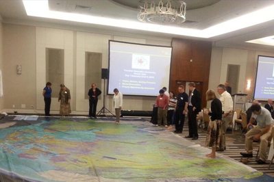
Canadian Geographic is providing Canadian educators (K to 12) with a new innovative hands-on creative way to teach Canada's rich geographic history to younger generations. Their "Giant Floor Map Program" is a free resource that teachers can borrow to help enhance students’ geography experiences through a hands-on, fun creative way to learn.
It is really hard to appreciate the true size, resolution and quality of these maps through photos on the web, however one of the maps were displayed at the June CGCRT national workshop that I attended and I must say, these giant floor maps are just as impressive as they sound and certainly will provide many young people with a new perspective for mapping and the spatial extent of Canada.
The Giant Floor maps are available on loan for 3-week periods ...

Geo-matching.com Adds New Categories
Geo-matching.com, the independent geomatics product comparison site that features detailed spec-based comparisons with user reviews for more than 750 geo related products. The site helps guide users through the maze of product specifications and provides them the opportunity to compare products from different suppliers and read other professionals’ reviews in order to reach a balanced judgment before buying.
Recently Geo-matching.com has added several new categories to the site including Gamma Spectrometers, USBLs, and Hydrographic Processing Software.

Houston GIS Training Company Expands to Calgary
TeachMeGIS, a Houston based GIS training company, has recently announced a decision to expand its public petroleum based GIS training classes to Calgary, Canada. This expansion has been expedited by the growing demand for geospatial skills in the industry.

Initial Flights with Airborne Hydrography AB Chiroptera II system
Earlier this year the Nova Scotia Community College (NSCC) announced that the Government would invest over seven hundred thousand dollars through the Canada Foundation for Innovation (CFI) that would help researchers at the Applied Geomatics Research Group (AGRG) unlock some of Nova Scotia’s coastline mysteries known as the “white ribbon gap” from the challenges involved with mapping shallow water coastal areas.
Last month, Leading Edge Geomatics (LEG), one of the industry partners involved with the project, worked along with staff from the NSCC / AGRG to install the Airborne Hydrography AB Chiroptera II system into a Beechcraft King Air 90C fixed wing aircraft, to perform the team’s first ever data acquisition with the Topobathymetric system.
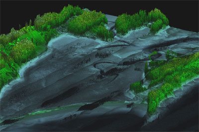
Leading Edge Geomatics Wayne Richardson, a Positioning/Project Manager with LEG has provided us with a general overview on the initial data acquisition Flights using the AHAB Chiroptera II topobathymetric system along with some sample data from their test flights of Sable Island.

How to use OpenSteetMaps
For people exploring various places in the neighborhood, it is similar maps as other online map information with zoom and pan, but the real power of OpenStreetMap rests in the hands of developers who can access all the data behind the maps for customizing to their own.
What it means that, with OpenStreetMap, you can not only view various spatial locations, but add also your own custom locations and information to the database which can then be used by other users. All you need to do is to ...

How do you compare geomatic and hydrographic products?
Geomatic and hydrographic tools and applications are advancing at a rapid pace, making it difficult to gain a clear overview of all the land surveying and hydrographic products currently available on the market.

Surrey launches Open Data Program
The City of Surrey launched its open data program today as part of its commitment to an open, transparent and accessible government. The new Open Data Catalogue comprises more data sets than any other municipality in Canada, and will increase efficiency and productivity for staff and public by making the data available to everyone on the City website.
