Alberta Open Data Portal makes data that the Government of Alberta collects on behalf of citizens publicly available. It contains a variety of datasets and publications by government departments and agencies.
The Taber Open Data collection includes LiDAR data, digital elevation models, topographic data and much more ...
The Town of Turner Valley Geographic Information System (GIS) provides residents, visitors, businesses and developers with information such as zoning, addressing, points of interest, road names and ortho photos. Please click on the link below to access the GIS mapping portal.
GeoDiscover Alberta provide quality, authoritative mapping data to citizens that falls under the open data license to the Alberta Government Open Data Site.
Utikuma Lake region is located in north-central Alberta. Open data for this area includes high-resolution satellite imagery, digital elevation models, LiDAR, topographic data, boundary data and more.
Beaver Hills, Alberta LiDAR Data - Contains lidar point clouds and derivative products: Classified point cloud, 1m DEM & DSM, Hill shade images.
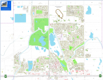
Download Town of Strathmore, Alberta Open Data and pre made maps
The Town of Okotoks provides a variety of interactive maps, prepared digital maps and GIS data layers.


